Header

Road biking, dirt road riding on Frankenbike, tandem riding, group riding, time trialing, randonneuring - I love to ride, and I love to write. As I've traveled along on two wheels, I've learned one thing: Expect Adventure. Join me on the journey!

Betty Jean Jordan

Tuesday, May 25, 2021

Shop Local/Ride Local 200K

This was such a fun ride right in my own backyard!  I did this ride three days ago as part of the 2021 Virtual Brevet Series.  After being on the road every weekend this month, I thought it would be nice to stick closer to home.  I devised a 200K route consisting of three loops.  Because I would be stopping at home several times, I was able to ride my lighter Factor instead of my supply-laden Trek.

Loop 1 (52 miles)

This past Saturday was the first day of our local farmers market season.  So, my first order of business was stopping by the Monticello square.

The new mural just off the square is almost finished.

I had seen the list of vendors ahead of time and looked forward to seeing a few of my regular farmers market friends.  I usually walk all around the farmers market to see what's available before I make my final selections.

I missed Leah, who sold pies at the farmers market for many years.  She was always dressed to the nines.  Last year she was the first person I knew who succumbed to COVID-19.  Her family continues to make pies.

It was good to see Shannon selling her beautiful plants and, of course, Laverne, maker of the rapturous fried pies!  I bought a peach fried pie to eat later during my ride.  (More on that to come.)  I also bought some locally made goat cheese with spices from Yellow Rose Farm.  I buy their goat's milk soap regularly; handmade soaps are a luxury I enjoy.  Lastly, I bought some fresh Georgia shrimp!  The vendor said he sells shrimp in other nearby towns and first came to Monticello last fall.  I think I remember reading about that, but I was out of town that day.  I took my goat cheese and shrimp to the office refrigerator to pick up later and made a new mental menu for that night's dinner.

Robert joined me at the office.  He had planned to ride my first loop with me, but, unfortunately, he only made it a few miles.  He's been battling a new tire that won't hold air.  He had to head home, hoping he could make it on his CO2 cartridge as well as mine that I gave him.

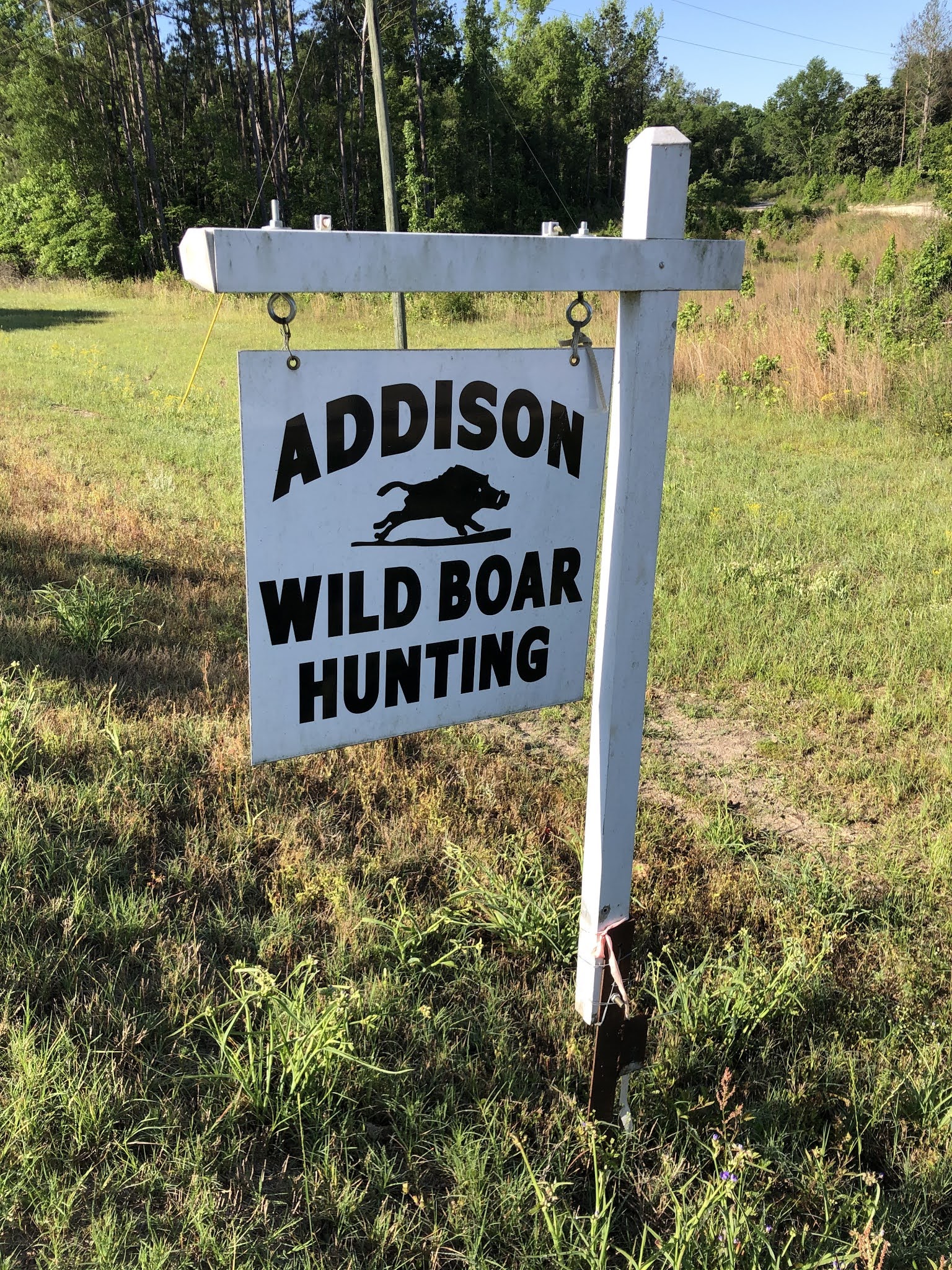
That was a downer about Robert having to bail, but I decided to focus on all the good things about the day.  There were tons of them.  I headed up Post Road, turned on Barr Bridge Road, and then went through Shady Dale.  Heading out of Shady Dale on Aikenton Road, I passed this sign.  It made me grin.

I rode a few miles in Putnam County, my only foray out of Jasper.  I stopped in Willard for a twofold purpose.  One was to check in there on Facebook.  I've checked in at Willard several times mainly as a joke with myself.  Willard is just the intersection of Georgia Highway 16 and Georgia Highway 142.  There's an abandoned building there.  Whenever I go through Willard, I think of the deejay Willard on 96 Rock, which I listened to growing up in Atlanta.  He just went by Willard; I never heard his last name.  In honor of Willard, I found a picture of an old 96 Rock license plate on the Interwebs.  People used to put them upside-down on the fronts of their vehicles.

It was also time for some bike food, specifically Laverne's fried pie!  They are always wonderful, but that may have been the best ever.  I stopped on the side of a quiet road beside some woods that are part of a wildlife management area.  I took the fried pie from my jersey pocket, where it had gotten slightly warm.  The crust was flaky and buttery, and the filling was soft and warm with chunks of peaches.  Simply delicious!

Toward the end of my first loop, I rode by a large tract that was timbered a few years ago.  A guy was standing on top of a pickup truck right next to it.  The truck said University of Georgia, and so I guess he was doing some kind of timber assessment.  He had a small gauge or controller box in one hand and a rod in the other.  Was he fishing or maybe using a Geiger counter?  When I told Robert about it later, he said the guy was probably flying a drone.  Anyway, as I rode past, I yelled out, "Expelliarmus!" but the guy didn't drop anything.

Loop 2 (52 miles)

I stopped briefly at home, where I said hello to Robert and the dogs, refilled my bottles, ate a few fresh strawberries, and enjoyed a real bathroom instead bushes.  Then, I headed back out on Goolsby Road toward Hillsboro.

It seemed a little strange not to continue south past Hillsboro like I usually do.  Instead, this time I headed north on Highway 11 and cut through Feldspar Road to go toward Clay Road.  This was the best way to minimize my time on Highway 16.  Highway 16 was necessary to get me to the highlight of my second loop, the Sac-o-Suds.

The movie My Cousin Vinny (1992) was filmed in and around Monticello.  The Sac-o-Suds, the site of the tuna "theft," is a real place.  We used to reenact one of the courtroom scenes from the movie for tourist groups.  I played Mona Lisa Vito, who was Marisa Tomei's character.  I'm not sure how I got involved in these skits (acting is definitely not my thing), but they were a lot of fun.  I had the hardest lines, which included things like limited slip differentials, Positraction, etc.  This is a photo from our  last reenactment, which was about four and a half years ago.

(L-R) me as Mona Lisa Vito, Rob Andrews as Judge Haller, Roger Harrison as Vinny Gambini

Back when the movie was filmed, the Sac-o-Suds was ready to go, as-is (or as-was).  It's changed ownership a few times since then but has remained a minor tourist attraction.  It closed a few years ago, but someone recently purchased it and remodeled it.  Fortunately, they were able to negotiate keeping the name.

A few days before this ride, I saw a Monticello-Jasper County Chamber of Commerce post on Facebook that the Sac-o-Suds had just reopened.  They had some great looking T-shirts (including some that said Two Yutes Tuna), and they would be selling BBQ plates from 2:00 - 5:00 PM on the day of my ride.  Perfect!  It would be a great lunch stop.  Also, it made up for the cancellation of my original ride lunch plans, the Methodist men's chicken-que.  I don't know what it is about Methodist men, but they know how to do chicken-que.  They must have secret lore they pass among themselves, like an obscure branch of the Freemasons.  BTW, I found out later that the chicken-que was cancelled because they couldn't get chickens.

I arrived at the Sac-o-Suds around 2:30 PM.  I didn't want to get there too late because I was afraid they would run out of BBQ.  No worries - it wasn't quite ready when I got there.  While I waited, I stood in the parking lot talking with a nice young man who owns a fencing company.  Good to know who I can call locally next time I need a fence.  We talked about all the people we know in common and recited lines from My Cousin Vinny.

Then I saw my friend Sandy, whom I hadn't seen in a long time.  She said she had just been talking about me when she was teaching a yoga class.  Apparently referring to a particular yoga move, she told them it would make their pooty pucker, a phrase I taught her.  The actual phrase is that something will make your pooky pucker.  I learned this from my Great Uncle Gene.  It applies when something is gross, disgusting, or heart-stopping.  Sandy gave a good example: when you look over the railing on the Blue Ridge Parkway, it makes your pooty pucker.  I didn't correct her phraseology, though.  It's just good to be remembered, even in the context of something making your pooty/pooky pucker.

At last the BBQ was ready!

A woman and her daughter had made all the food.  I think maybe they are the owners, but I'm not sure.  There was a nice guy working the cash register, too.  He said that the women wanted constructive criticism from the BBQ customers.  I told him that the coleslaw was particularly good - very fresh and flavorful.  I liked that it was vinegar based instead of mayonnaise based.  The BBQ was good, too, but I like mine a little spicier.  However, because not everyone else likes theirs hot, maybe they could have a spicy BBQ sauce on the side.  I told him about an older man named Gene Mathis who used to be the City of Monticello building inspector and Santa Claus (he looked the part).  Gene always wore a holster that held a tiny bottle of Tabasco.  Maybe I should do the same because I've found myself in need of hot sauce several times recently.  As I told this to the Sac-o-Suds cashier, I noticed that he had a holster with a gun.  (I don't blame him, running a convenience store.)  We agreed that he should add a bottle of Tabasco, too.

My energy level was up as I continued on my ride.  I definitely had needed food.  I was thinking that I had about 42 miles to go, but then I realized that I had only 20 miles left in this loop.  Breaking my 200K into sections did make it seem easier.  I rode some familiar roads on the north side of the county and then went back to my house.

Loop 3 (22 miles)

I had completed a little over a century, which would have been a respectable ride on its own.  However, I was determined to complete my 200K.  I headed out once more for my shortest loop, about 22 miles - easy!  Even better, I planned to stop at Dairy Queen toward the end.  Only 18 miles - a little over an hour - to a Blizzard!

I rode by the old Georgia-Pacific plant.  There's a rail spur there.  I think these are some kind of rail maintenance vehicles.  Although they are gas (or maybe diesel) powered, this long line looks like some kind of steampunk fantasy:

Even with 100+ miles already in my legs, I enjoyed the final miles. I rode to the Dairy Queen, and lo and behold, there was Robert!  Actually, I kind of suspected he would meet me there :)

Dairy Queen has several summer Blizzard flavors.  I had researched them ahead of time and decided on a frosted animal cookie Blizzard.  In addition to frosted animal cookies, it also has pink confetti frosting.  It tastes like the circus.

Robert got the Drumstick Blizzard.  This one has pieces of Drumstick ice cream cones and peanuts.  I considered this one, too, but figured it would be a lot like some of the regular Blizzard flavors.  Robert confirmed that it was pretty much the same as about three other flavors that have chocolate and peanuts.  I tried a bite of his Blizzard - yep, it tasted like a Snickers Blizzard.  Not bad by any means, but at least I had gotten something significantly different.

As I rolled out of the Dairy Queen parking lot, I stopped to smell the magnolias blooming along the back fence.

Only four miles to the finish!  Robert offered to go by the office to pick up the refrigerated stuff I had gotten at the farmers market.  Yea!  Now I didn't have to figure out how to carry the bag as I rode my bike.

I took a shower and then joined Robert on the patio for adult beverages.  As we walked back inside, we admired the wildflowers that Robert planted beside our driveway last year.

I had already planned to make tomato grits as a side dish for another meal this week.  For that night's dinner I converted the grits to an entrĂ©e and added the fresh shrimp I had gotten at that morning's farmers market.  I also made a salad with the greens, radishes, and turnip's from the week's CSA delivery.  I topped it with my favorite vinaigrette, but instead of the usual blue cheese, I added some goat cheese from the farmers market.  All these good eats make me glad I live in Georgia.


Sunday, May 23, 2021

Promised Land 200K

I have been to the Promised Land, and it has fried chicken.  Praise the Lord and pass the biscuits.

The revamped RUSA permanent program that started last year is great.  You schedule permanents online rather than having to coordinate with a route owner.  You can sign up for a permanent anytime, even up to the last minute.  You can start from any control.  You can change the route between controls as long as you ride at least as many kilometers total as the original route.  The one downside, at least here in Georgia, is that we have many fewer permanent routes now than under the old system.  I guess that's because most of the owners under the old system have not re-submitted their routes under the new system.  Oh, well.  I've mainly been doing the Athens 200K permanent because it's the closest one to me, especially being able to start at the control in Eatonton.  However, I decided to shake things up a bit last weekend and do the Promised Land 200K.

I did the Promised Land route once before, as a brevet on New Year's Day 2017.  It was cold and overcast then, but last Saturday it was warm and sunny.  It starts in Evans, GA, but it's only two miles to the state line.  The rest is in South Carolina.  I think this was the first time I had been outside of Georgia since before the pandemic.

I got up early that morning, wanting to sleep as late as I could but trying not to start my ride too late.  It was about a two-hour drive to the starting control, a Circle K.  Then, it would be a long day on the bike, followed by another two-hour drive home.  I got on the road at about 8:45 AM, not too bad.

Several cars carrying bicycles passed me in the first few miles.  I soon discovered why.  Not too far into South Carolina, I passed the Forks Area mountain bike trailhead.

A few miles later, I passed a pick-your-own strawberry farm.  It already had a lot of customers.  I would have liked to join them, but I didn't want to stop, and despite my Yogi Bear picnic basket, I didn't have a practical way to carry strawberries.

It was a beautiful morning.  The sky was bright blue, and it was getting warmer.  I started out with arm and knee warmers, but I didn't need them for more than a few hours.

Many roads during the first half were state highways with those horrid rumbles all along the white line.  Fortunately, traffic was light, and so the rumbles weren't a big issue.

I was amused by this sign:

I'd joke that this is truth in advertising, but the church gets its name from being on Republican Road.  Although both the road and the church predate the current political nastiness, it's still an unfortunate name.  I definitely had not yet reached the Promised Land.

The first control was in Edgefield.  I was carrying plenty of food and liquids and, therefore, didn't need to stop there for supplies.  I did stop for a few photos, though.

Who's that turkey riding a bicycle?

Maybe I was prescient.  The night before I had dreamed that my friend Kathleen was governor of Georgia.  That would be an exponential improvement, but I was concerned about when our group of friends might get together for dinner.

I continued my journey to the Promised Land.  Promised Land, SC, that is, and, more particularly, Promised Land Grocery, which was the next control.

Pedaling down the road, I remembered an old hymn I hadn't thought of in forever:

        I am bound for the promised land,
        I am bound for the promised land,
        Oh who will come and go with me?
        I am bound for the promised land.

I could only remember the chorus, but it was fun to belt it out a few times.  That was one good thing about riding by myself - no way I'd sing if others were around.

Promised Land Grocery was about halfway through the route.  When I had done this as a brevet, the organizer was Gator, a fellow randonneur whom I think created the route.  Gator had recommended the fried chicken at Promised Land Grocery.  Someone named Gator surely would know about good fried chicken.  I had gotten some on my first visit and also remembered his advice last Saturday.


All I was missing was hot sauce.

As I sat outside eating my chicken, several nice local people greeted me.  One guy named D.B. was particularly friendly.  He apologized if he was being too personal, but he wondered how far I was riding.  (That didn't bother me at all; people often ask that question.)  He was amazed and asked if a camera was following me.  I laughed and told him I do long rides all the time and that lots of other people do, too.  Then, when I said that I know I'm crazy, he disagreed.  He said he'd love to be out riding a bicycle if his health allowed it.  He played football and boxed when he was young, and he remembered the adrenaline he felt from those activities.  He imagined that it was the same for me riding a bicycle.  That was really cool that we could relate to each other like that.

Fueled body and soul, I continued toward Abbeville, an out-and-back spur on the northern end of the route.  It was relatively uneventful.  I didn't even stop in Abbeville as I still was carrying plenty of food and water.

Around mile 90 I was ready for another stop.  I found a grassy area with a nice view of a field across the road.  I took off my shoes, not because I was on holy ground but to minimize the chance of hotspots on my feet.  Still, as I sat on the ground in my stocking feet, eating a cheese sandwich on a beautiful spring afternoon, I sensed the sacred in the everyday.

The latter miles were one of the prettiest parts of the route, through Sumter National Forest.  Then, I saw a sign.  It wasn't from heaven but from the South Carolina DOT: Road Closed Ahead - Bridge Out.  It was late in the ride, and I was getting tired.  I didn't want to add miles with a detour, and so I forged ahead, trusting that I still could get through on my bicycle.  I mentally prepared to walk through a creek if necessary, something I've done several times before.

I continued on the road through the national forest, even quieter than usual, I suppose, because of the detoured traffic.  After a few miles, I reached the spot where the bridge was out.  A man and two teenage girls were sitting in front of a barricade.  I thought they might try to deter me, but they did just the opposite.  As I approached, the man moved one of the road signs so that I didn't even have to get off my bicycle!  I thanked them and kept riding.  The bridge repair was mostly complete.  I only had to dismount at the far side, and I didn't have to get into the water at all.  It was pretty easy as far as bridge-outs go.

Thankful to be through that tricky spot, I focused on the approximately 20 miles remaining.  I was feeling pretty good - probably because I had fueled well, including electrolyte drinks - but I needed one more water refill to get me to the end.  I figured I would pass a church fairly soon.  Yep, within a few miles, there one was.

I rode around the church looking for an outdoor spigot.  I finally found one on the last wall I checked (that's the way it always goes).  Next step - would the spigot actually work?  I turned the knob, and...nothing.  Then I noticed that it was hooked to some kind of tank.  Also, there was a cap on top of an additional opening on top of the spigot, a strange configuration I hadn't seen before.  I took off the cap, turned the knob again, and water sprayed straight up like a geyser!  I got a slight shower, which felt OK on the warm afternoon.  I didn't want to mess up anything, and so I used one bottle to divert water into the other.  Not much MacGyvering as far as randonneuring goes, but I got the job done.

The last eight miles retraced the first part of the route.  I was glad to make it back to Georgia and, more specifically, to the Circle K.  Another safe and successful permanent.  Hallelujah!

Tuesday, May 18, 2021

Ocmulgee Pedal-Paddle

After cycling, my favorite outdoor activity is kayaking.  I don't kayak as much as I'd like, and so I'm glad when I do get out on the water.  The Georgia River Network hosts a number of paddling events during the year.  These weren't on my radar screen until I received an e-mail that mentioned a new type of event for pandemic times, the Pedal-Paddle.  Instead of taking a shuttle with a bunch of other people, you ride your bicycle from the outtake to the put-in.  I checked the 2021 Pedal-Paddle schedule and selected the one on the Ocmulgee River Saturday a week ago.  I loved it.  I knew I would.

Robert kindly let me use his 4Runner and even hooked up the trailer for me.  One reason we got the trailer was to make it easier to carry out kayaks (rather than muscling them into the rack on top of the truck).  I carried my cyclocross bike in the back of the 4Runner.  I opted for it instead of my road bike because the last part of the pedal portion of the pedal-paddle was to be on a dirt road.

I drove to the put-in, about eight miles north of Abbeville.  Joe Cook coordinates the Georgia River Network events.  He had provided directions to the launch site, Ochise Landing, noting that it is close to another launch site and not to go to the other one.  Because he provided GPS coordinates to the correct site, I used those to navigate.  That worked great.  However, right before the final turn onto the dirt road, a bridge was out!  Fortunately, Joe had provided his cell phone number, and so I called him and found out the new launch site, which was the other site that he had originally told us not to go to (the Dodge County public boat ramp).  He and the other volunteers hadn't discovered that the bridge that was out until the night before.  I guess I didn't get the group text about the changed location.  No worries, though.  I made it to the Dodge County public boat ramp in plenty of time.

Pedaling

After dropping off my kayak, I drove to Half Moon Landing in Abbeville, our takeout.

From there, I rode my bicycle to the put-in, about 11 miles away.  Along the way I passed this local wild boar hunting company.

That was supposed to be the day of the Abbeville Wild Hog Festival, but because of the pandemic they postponed it until the fall.  I was sad to miss it.

I was one of the first people to arrive at the launch site.

It wasn't hard to stay entertained while I waited.

Several roosters were running around.

I noticed a sign on the light pole next to the boat launch.  The fisherman who happened to be standing there gives perspective to the flood height on 7/10/94.  Although I was still in Atlanta during the Great Flood of 1994, I certainly remember how it affected Middle and South Georgia.


One of the volunteers said he was going to walk to the end of the road to cheer on people as they arrived.  That sounded like fun, and so I followed suit.  We were on River Road.  I was amused by this appropriately named family who lives here:

I wonder if they know about the Bass Pro Shop on Bass Road in Macon.  (The road was already there when Bass Pro Shop moved in.)

As I continued walking along the road, I passed a field of cows.  They came running toward me.

I'm sure they thought I was going to give them something to eat.  Alas, I didn't have any food, but I got to pet a couple on the nose.

As everyone arrived, volunteers loaded our bicycles onto a trailer for transport back to the takeout.  That's my Cannondale on the outside.

Paddling

Joe gave a brief overview of our paddling journey.  He also introduced two young women from the Adopt-A-Stream program with the Georgia Environmental Protection Division.  Adopt-A-Stream is a citizen outreach program to educate and involve the public in protecting our waters.  These young women collected water samples throughout the day to measure pH, dissolved oxygen, macroinvertebrates, and other parameters of stream quality.  Finally, we got into the water!

The Dodge County public boat ramp is on a partial oxbow lake.  When the river is lower, this site is disconnected from the main Ocmulgee River channel.  That's why the original plan was to launch from the newer Ochise Landing.  Fortunately, we had enough flow that day to paddle from here.

Joe had us go upstream instead of downstream because the brush is heavier on the downstream end of the oxbow.  It was about a half-mile paddle upstream to get to the cut through, i.e., the main river channel.  I really hadn't given much thought to the effort of paddling upstream, but after we turned downstream, it definitely was easier.

Approaching the cut through

I thoroughly enjoyed being on the water.  Every time I paddle, I wonder why I don't do it more often.  And how great to get to explore a portion of the Ocmulgee River I hadn't been on before!

Georgia Geography

While we paddled, I chatted with Joe about Georgia geography.  Here's a fun trivia question he asked me: If you travel on I-16 from Macon to Savannah, you cross five major rivers.  What are they?  Hint: They form the acronym COOOO (not in that order geographically).

Answer: (geographically from west to east): Ocmulgee, Oconee, Ohoopee, Canoochee, and Ogeechee

He also said that there are 31 counties in Georgia that aren't named for dead white guys.  Based on my post-paddle Interwebs research, I could only find 13 that aren't named for dead white guys (maybe Joe had his digits reversed).  I think I thought of most, if not all, of them while I was paddling: Catoosa, Chattahoochee, Chattooga, Cherokee, Coweta, Hart, Liberty, Muscogee, Oconee, Peach, Rockdale, Seminole, and Union.  As you can see, most of these counties have Native American names.  Only one Georgia county is named for a woman: Hart for Nancy Hart, a heroine from the American Revolution.  By the way, Georgia has 159 counties total, more than any state but Texas.  It also has more Native American place names than any other state.

One more Georgia geography tidbit that I've been thinking about: many Georgia cities and counties have the same name but are in different geographical locations.  For example, we've gotten phone calls about cheap land in Jasper.  Yes, land costs less here in Jasper County, located in Middle Georgia, than in the City of Jasper, located in the mountains of North Georgia.  I couldn't find a list of noncorresponding Georgia cities/towns and counties, and so I compiled my own.  The index of the Georgia DOT road map was a great resource for finding some tiny, unincorporated towns to include.  (Note that I included only names that are exactly the same.  There are even more examples if you include names like Waynesboro, which is not in Wayne County.)

  • Appling
  • Baldwin
  • Bartow
  • Brantley
  • Brooks
  • Butts
  • Calhoun
  • Candler
  • Cobb
  • Colquitt
  • Clayton
  • Crawford (and to confuse things, there's also a Crawfordville, which is in Taliaferro County, which is pronounced "Tolliver")
  • Dawson
  • Decatur
  • Douglas
  • Evans
  • Forsyth
  • Franklin
  • Gordon
  • Haralson
  • Jackson
  • Jasper
  • Jefferson
  • Jones
  • Lanier
  • Lumpkin
  • Macon
  • Madison
  • McIntosh
  • Mitchell
  • Monroe
  • Morgan
  • Newton
  • Oconee
  • Oglethorpe
  • Pulaski
  • Putnam
  • Quitman
  • Screven
  • Stephens
  • Towns
  • Union
  • Washington
  • White
  • Worth
I may have missed one, but this is certainly enough confusion.  Oh, and don't forget that there are two towns named Pine Mountain, one near Callaway Gardens on the western side of Georgia and one in the mountains in the very northeast corner of the state.  OK, now back to my paddling report.  Sometimes you just have to go with the flow :)

A Slough of Fun

After a while, Joe asked the group if we wanted to do some exploring.  Of course!  He led us into the first of several sloughs we paddled through.  A slough is a swamp adjacent to the river.  Sloughs aren't accessible when the river is down during the summer.  On the other hand, on this trip when the river was relatively high, there were almost no sandbars for stopping - kind of a tradeoff.  I was glad to learn about the sloughs, though.  They were magical.


Joe spotted the nest of a yellow-crowned night heron:


It was hard for me to see the heron in the trees, much less get a photo.  Joe got a good picture:

Photo credit: Joe Cook

Next, our group paddled through this "gateway" to our lunch spot in the slough.


This was the last place I expected to see a deer stand!  It must usually be dry in this area during deer season in the fall.


We all parked our boats for lunch.


View of the main Ocmulgee channel from the slough where we stopped for lunch

One of the paddlers made a friend!  (Cope's gray tree frog)


I see you!
Photo credit: Joe Cook

After lunch we continued down the river.  Someone pointed out this pretty aquatic plant.  Later, I entered this photo into my iNaturalist app (great app for IDing plants and animals!) and learned that it's floating marsh pennywort.


One of the paddlers had brought her 5-month-old puppy with her.  The puppy made the best paddling companion!


Time to explore another slough:


Cypress knees

My knees (and helmet in the bottom of my kayak)

I had so much fun playing in the sloughs that I was one of the last ones out.  I caught up to the group and saw that they looking intently at something.  It was a nest of baby herons.  As before, I didn't get a very good photo, but Joe did!

Photo credit: Joe Cook

Sneaky: Snakes and Otherwise

One of the last places we visited was Poor Robin Spring, just off of the river.  The spring pumps water from the Floridan aquifer.  It once was a recreation site, but today a company owns it that produces bottled spring water.  We paddled close enough to step out onto the embankment and view the bright blue water.


Back out on the main river is the former site of Poor Robin's Ferry.  The Georgia River Network provided some interesting history of this location:

On May 8, 1865, Confederate President Jefferson Davis, his family, and a small entourage crossed the Ocmulgee here on what was then known as Brown's Ferry.  Davis, having been forced from the Confederacy's Richmond capital a month earlier, hoped to make it to the west and rally the remains of the Confederate Army there.  Meanwhile, the Union Army, believing that he was complicit in the April 15 assassination of President Lincoln, was in hot pursuit.  And, soldiers were especially interested in the $100,000 bounty for his capture.  On the morning of May 10, Davis was captured about 26 miles southwest of Abbeville.  Even surrounded, Davis attempted to flee under the cover of his wife's overcoat but was quickly apprehended.  His capture in a woman's clothes was exploited with much hyperbole as northern newspapers depicted the incident with Jefferson in a wig and hoop skirt.  The dramatic capture led to a popular song of the era, "Jeff in Petticoats," with the lyrics: "Just on the outskirts of a wood, his dainty shape was seen.  His boots stuck out, and now they'll hang old Jeff in crinoline!"  Davis was never executed.  He spent more than two years in jail and became a symbol of Southern nationalism during Reconstruction.

What an interesting coincidence that our Pedal-Paddle adventure was on the same date that Jefferson Davis crossed the Ocmulgee, May 8.  And it sounds like politics now is as icky as it's always been.

Speaking of snakes, we got to see a live one back on the main river channel.  At first I thought it was a rattlesnake, but it was just a nonvenomous brown watersnake.  Again, I'll defer to Joe's much better picture than mine:

Photo credit: Joe Cook

I watched it for a bit, but I missed the most exciting part.  Someone else said it dove into the water and came back up with a fish in its mouth!

One other snake-related note: I learned about a bird species unfamiliar to me, the snakebird or, more formally, the anhinga.  It swims through the water with only its long neck exposed, making it look like a snake.  It has specialized muscles and a hinge in its neck.  When an unwary fish swims near, the anhinga's head darts forward and impales the prey.  Although I didn't get to see an anhinga in the water, I learned about it as one flew by and another paddler told me what it was.

If at all possible, get out and experience Georgia's rivers.  As I was paddling, I marveled at their astonishing beauty and how seemingly few people know about this wonderful treasure.  If you'd like to enjoy and protect our rivers, check out and support the Georgia River Network, https://garivers.org/.