I rode from the highway onto a dirt access road leading to
an area of clear-cut timber. A man
called out to me. He was a hunter whose
club leases the property. He was camping
out in a small trailer. He said that no
one was hunting that day (yea!) and was fine with me traversing the property to
get to the confluence. Although he
seemed a little bemused by my appearance, he sounded kind of interested in my
adventure, too. I told him that I was
looking for a particular latitude and longitude, kind of like geocaching or
treasure hunting.
At first, I didn’t see the logging road, which has grown up
and is more of a trail now. In fact, I
didn’t find it until I was walking back from the confluence because a big pile
of brush from the clear-cutting had blocked it from my initial view. So, I laid my bike down where I could find it
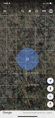
again and set out on foot with the Google Earth app on my phone.
I walked across the clear-cut area, watching the lat/long on
my phone and refreshing it periodically to get a current reading. There were a few briars, but they weren’t
bad. Trekking was fairly easy even in my
cycling clothes and shoes. Also, because
it was winter, ticks weren’t an issue.
The hunter had asked me to keep an eye out for deer, but all I saw was a
rabbit.
I moved from the clear-cut area to woods that had not been
timbered. I was very close on latitude,
but I was having a hard time zeroing in on the longitude. Then I remembered that my phone also has a
compass. I was a little too far north
and a little too far west; therefore, I used my compass to walk southeast. I realized that my sense of north had been slightly
off because the sun is so far south while we’re close to the winter solstice. The compass also gave me lat/long, which
matched the lat/long on my Google Earth app, giving me more confidence in my
location (or at least my phone’s GPS receiver).
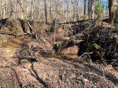
As I got closer to the confluence, I saw a creek. I remembered previous confluence reports
mentioning a creek. I climbed down an
embankment to stand next to the creek and – woo hoo – all zeroes! (minutes and seconds)
I took the photos required to submit an official visit report to the Degree Confluence Project (check out http://confluence.org/ for more details).
 |
| "All zeroes" at the bottom |
 |
| General area of the confluence |
 |
| View to the north |
 |
| View to the east |
 |
| View to the south |
 |
| View to the west |
 |
| These shoes were definitely more handy than an iguana on this outing. |
After taking the required photos and spending a few minutes reveling in the beautiful day and successful visit, I headed back toward my bicycle. I ate the slices of Claxton fruitcake that I had brought as bike food and marveled at how my phone has more computing power than the computers that existed at the time Neil Armstrong walked on the moon.
Walking as straight a line as I could reckon, I found the trail (logging road) that would have led me almost right to the confluence. I picked up my bike, said goodbye to the hunter, and pedaled away.
The Peach Peloton route was 73 miles, but I shortened my ride to 63 miles so that Robert didn't have to wait so long for me back at the car. He said that several of the guys commented that it was their favorite Peach Peloton ever. I agree!


